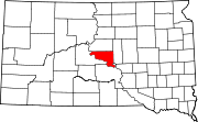
Tiedoston ”Tiedosto:Map of South Dakota highlighting Hughes County.svg” järjestelmänlaajuinen käyttö
Siirry navigaatioon
Siirry hakuun
Tämä sivu näyttää, missä muissa wikeissä tiedostoa käytetään. Löydät nämä tiedot myös tiedoston kuvaussivun alalaidasta.

Käyttö sivustolla ar.wikipedia.org
- مقاطعة هيوز (داكوتا الجنوبية)
- بيير
- هارولد (داكوتا الجنوبية)
- بلونت
- قالب:مقاطعة هيوز (داكوتا الجنوبية)
Käyttö sivustolla bar.wikipedia.org
Käyttö sivustolla bg.wikipedia.org
Käyttö sivustolla bpy.wikipedia.org
Käyttö sivustolla ca.wikipedia.org
Käyttö sivustolla cdo.wikipedia.org
Käyttö sivustolla ceb.wikipedia.org
Käyttö sivustolla ce.wikipedia.org
Käyttö sivustolla cy.wikipedia.org
Käyttö sivustolla de.wikipedia.org
- Pierre (South Dakota)
- Liste der Countys in South Dakota
- Hughes County (South Dakota)
- Crow Creek Reservation
- Vorlage:Navigationsleiste Orte im Hughes County (South Dakota)
Käyttö sivustolla en.wikipedia.org
- Pierre, South Dakota
- List of counties in South Dakota
- Hughes County, South Dakota
- Blunt, South Dakota
- Harrold, South Dakota
- Crow Creek Indian Reservation
- Template:Hughes County, South Dakota
- User:Nyttend/County templates/SD
- National Register of Historic Places listings in Hughes County, South Dakota
- Category:Populated places in Hughes County, South Dakota
- Canning, South Dakota
- De Grey, South Dakota
- Joe Creek, South Dakota
- Raber Township, Hughes County, South Dakota
- User:InverseWeiner/sandbox
- Oahe Acres, South Dakota