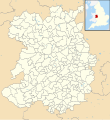
Tiedosto:Shropshire UK parish map (blank).svg
Ulkoasu

Tämän PNG-esikatselun koko koskien SVG-tiedostoa: 550 × 599 kuvapistettä. Muut resoluutiot: 220 × 240 kuvapistettä | 441 × 480 kuvapistettä | 705 × 768 kuvapistettä | 940 × 1 024 kuvapistettä | 1 880 × 2 048 kuvapistettä | 1 198 × 1 305 kuvapistettä.
Alkuperäinen tiedosto (SVG-tiedosto; oletustarkkuus 1 198 × 1 305 kuvapistettä; tiedostokoko 2,75 MiB)
Tiedoston historia
Päiväystä napsauttamalla näet, millainen tiedosto oli kyseisellä hetkellä.
| Päiväys | Pienoiskuva | Koko | Käyttäjä | Kommentti | |
|---|---|---|---|---|---|
| nykyinen | 10. lokakuuta 2010 kello 02.35 |  | 1 198 × 1 305 (2,75 MiB) | Nilfanion | {{Information |Description=Blank map of Shropshire, UK with civil parishes shown. Equirectangular map projection on WGS 84 datum, with N/S stretched 165% Geographic limits: *West: 3.25W *East: 2.15W *North: 53.03N *South: 52.27N |Source |
Tiedoston käyttö
Seuraava sivu käyttää tätä tiedostoa:
Tiedoston järjestelmänlaajuinen käyttö
Seuraavat muut wikit käyttävät tätä tiedostoa:
- Käyttö sivustolla en.wikipedia.org

