Tiedosto:Outer Hebrides UK location map.svg
Siirry navigaatioon
Siirry hakuun

Tämän PNG-esikatselun koko koskien SVG-tiedostoa: 456 × 600 kuvapistettä. Muut resoluutiot: 182 × 240 kuvapistettä | 365 × 480 kuvapistettä | 584 × 768 kuvapistettä | 779 × 1 024 kuvapistettä | 1 557 × 2 048 kuvapistettä | 1 083 × 1 424 kuvapistettä.
Alkuperäinen tiedosto (SVG-tiedosto; oletustarkkuus 1 083 × 1 424 kuvapistettä; tiedostokoko 3,25 MiB)
| Tämä tiedosto on tiedostotietokanta Wikimedia Commonsista. Tiedot kuvaussivulta näkyvät alla. |  |
Tiedoston kuvaussivu Commonsissa |
| Kuvaus |
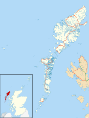
Blank map of the Outer Hebrides (excluding Sula Sgeir), UK with the following information shown:
Equirectangular map projection on WGS 84 datum, with N/S stretched 180% Geographic limits:
|
| Päiväys | |
| Lähde |
|
| Tekijä | Nilfanion, created using Ordnance Survey data |
| Käyttöoikeus (Tämän tiedoston uudelleenkäyttö) |
Tämä tiedosto on lisensoitu Creative Commons Nimeä-JaaSamoin 3.0 Ei sovitettu -lisenssillä. Nimeä: Contains Ordnance Survey data © Crown copyright and database right
|
| Muut versiot | File:Outer Hebrides UK blank map.svg - Blank map |
Tiedoston historia
Päiväystä napsauttamalla näet, millainen tiedosto oli kyseisellä hetkellä.
| Päiväys | Pienoiskuva | Koko | Käyttäjä | Kommentti | |
|---|---|---|---|---|---|
| nykyinen | 26. syyskuuta 2010 kello 23.23 | | 1 083 × 1 424 (3,25 MiB) | Nilfanion | {{Information |Description=Blank map of the Outer Hebrides (excluding Sula Sgeir), UK with the following information shown: *Administrative borders *Coastline, lakes and rivers *Roads and railways *Urban areas Equire |
Tiedoston käyttö
Seuraavat 3 sivua käyttävät tätä tiedostoa:
Tiedoston järjestelmänlaajuinen käyttö
Seuraavat muut wikit käyttävät tätä tiedostoa:
- Käyttö kohteessa ar.wikipedia.org
- Käyttö kohteessa bg.wikipedia.org
- Käyttö kohteessa ceb.wikipedia.org
- Käyttö kohteessa de.wikipedia.org
- Käyttö kohteessa en.wikipedia.org
- Outer Hebrides
- Stornoway Airport
- Lochboisdale
- Daliburgh
- Callanish
- Stornoway
- Kisimul Castle
- Uig, Lewis
- Rodel
- RRH Benbecula
- Leverburgh
- Castlebay
- Balivanich
- Cladh Hallan
- Back, Lewis
- Knock, Isle of Lewis
- Ardmore, Barra
- Ness, Lewis
- Barra Airport
- Portnaguran
- Aignish
- Dun Carloway
- Shawbost
- Gravir
- Barvas
- Garenin
- Achmore, Lewis
- Aird, Lewis
- Ardhasaig
- Balallan
- Bragar
- Lochmaddy
- Hushinish
- Carloway
- Tarbert, Harris
- Benbecula Airport
- Northbay
- Sollas
- Howmore
Näytä lisää tämän tiedoston järjestelmänlaajuista käyttöä.