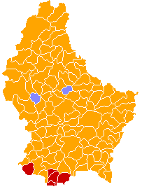
Tiedosto:Luxembourg legislative election 2004 communes map.png
Siirry navigaatioon
Siirry hakuun
Luxembourg_legislative_election_2004_communes_map.png (203 × 270 kuvapistettä, 7 KiB, MIME-tyyppi: image/png)
Tiedoston historia
Päiväystä napsauttamalla näet, millainen tiedosto oli kyseisellä hetkellä.
| Päiväys | Pienoiskuva | Koko | Käyttäjä | Kommentti | |
|---|---|---|---|---|---|
| nykyinen | 1. maaliskuuta 2008 kello 23.17 |  | 203 × 270 (7 KiB) | Bastin8 | {{Information| |Description=A map of communes of Luxembourg after mergers of 2006-01-01, colour-coded by geographic area. Area is denoted by eight different shades of green; in order of increasingly darker shades, the lower bounds (in km²) are: 0, 10, 1 |
Tiedoston käyttö
Seuraava sivu käyttää tätä tiedostoa:
Tiedoston järjestelmänlaajuinen käyttö
Seuraavat muut wikit käyttävät tätä tiedostoa:
- Käyttö sivustolla ca.wikipedia.org
- Käyttö sivustolla en.wikipedia.org
- Käyttö sivustolla fr.wikipedia.org
- Käyttö sivustolla ru.wikipedia.org
- Käyttö sivustolla www.wikidata.org

