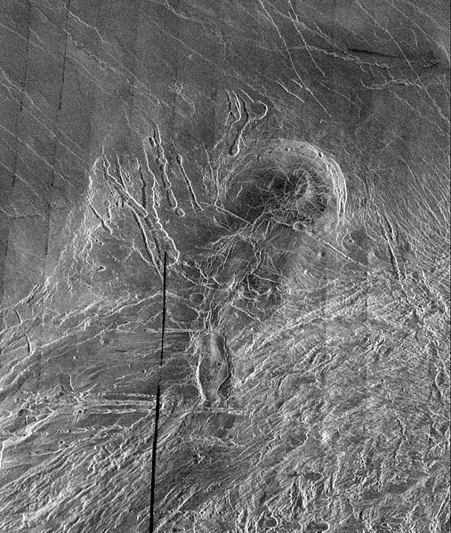
Tiedosto:Lakshmi Planum and Siddons Patera PIA00240.jpg
Siirry navigaatioon
Siirry hakuun

Tämän esikatselun koko: 507 × 599 kuvapistettä. Muut resoluutiot: 203 × 240 kuvapistettä | 406 × 480 kuvapistettä | 650 × 768 kuvapistettä | 866 × 1 024 kuvapistettä | 1 732 × 2 048 kuvapistettä | 3 073 × 3 633 kuvapistettä.
Alkuperäinen tiedosto (3 073 × 3 633 kuvapistettä, 3,76 MiB, MIME-tyyppi: image/jpeg)
Tiedoston historia
Päiväystä napsauttamalla näet, millainen tiedosto oli kyseisellä hetkellä.
| Päiväys | Pienoiskuva | Koko | Käyttäjä | Kommentti | |
|---|---|---|---|---|---|
| nykyinen | 7. huhtikuuta 2008 kello 07.38 |  | 3 073 × 3 633 (3,76 MiB) | Bryan Derksen | {{Information |Description={{en|This image is a full-resolution mosaic of several Magellan images and is centered at 61 degrees north latitude and 341 degrees east longitude. The image is 250 kilometers wide (150 miles). The radar smooth region in the nor |
Tiedoston käyttö
Seuraava sivu käyttää tätä tiedostoa:
Tiedoston järjestelmänlaajuinen käyttö
Seuraavat muut wikit käyttävät tätä tiedostoa:
- Käyttö sivustolla be.wikipedia.org
- Käyttö sivustolla bn.wikipedia.org
- Käyttö sivustolla cs.wikipedia.org
- Käyttö sivustolla fr.wikipedia.org
- Käyttö sivustolla hi.wikipedia.org
- Käyttö sivustolla hy.wikipedia.org
- Käyttö sivustolla ja.wikipedia.org
- Käyttö sivustolla nl.wikipedia.org
- Käyttö sivustolla ru.wikipedia.org
- Käyttö sivustolla sr.wikipedia.org
- Käyttö sivustolla ta.wikipedia.org
- Käyttö sivustolla uk.wikipedia.org
- Käyttö sivustolla zh.wikipedia.org


