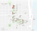
Tiedosto:INHP NPS map.svg
Siirry navigaatioon
Siirry hakuun

Tämän PNG-esikatselun koko koskien SVG-tiedostoa: 717 × 599 kuvapistettä. Muut resoluutiot: 287 × 240 kuvapistettä | 574 × 480 kuvapistettä | 919 × 768 kuvapistettä | 1 225 × 1 024 kuvapistettä | 2 450 × 2 048 kuvapistettä | 1 511 × 1 263 kuvapistettä.
Alkuperäinen tiedosto (SVG-tiedosto; oletustarkkuus 1 511 × 1 263 kuvapistettä; tiedostokoko 880 KiB)
Tiedoston historia
Päiväystä napsauttamalla näet, millainen tiedosto oli kyseisellä hetkellä.
| Päiväys | Pienoiskuva | Koko | Käyttäjä | Kommentti | |
|---|---|---|---|---|---|
| nykyinen | 28. toukokuuta 2011 kello 21.54 |  | 1 511 × 1 263 (880 KiB) | Apollo1758 |
Tiedoston käyttö
Seuraava sivu käyttää tätä tiedostoa:

