Tiedosto:France location map.svg
Siirry navigaatioon
Siirry hakuun

Tämän PNG-esikatselun koko koskien SVG-tiedostoa: 626 × 600 kuvapistettä. Muut resoluutiot: 251 × 240 kuvapistettä | 501 × 480 kuvapistettä | 802 × 768 kuvapistettä | 1 069 × 1 024 kuvapistettä | 2 138 × 2 048 kuvapistettä | 1 041 × 997 kuvapistettä.
Alkuperäinen tiedosto (SVG-tiedosto; oletustarkkuus 1 041 × 997 kuvapistettä; tiedostokoko 643 KiB)
| Tämä tiedosto on tiedostotietokanta Wikimedia Commonsista. Tiedot kuvaussivulta näkyvät alla. |  |
Tiedoston kuvaussivu Commonsissa |
Yhteenveto
| Kuvaus |
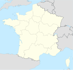
Deutsch: Positionskarte von Frankreich
Quadratische Plattkarte, N-S-Streckung 140 %. Geographische Begrenzung der Karte:
English: Location map of France
Equirectangular projection, N/S stretching 140 %. Geographic limits of the map:
Français : carte des régions Françaises |
||
| Päiväys | 02-07-2008 | ||
| Lähde | Oma teos (Original text: own work, using United States National Imagery and Mapping Agency data) | ||
| Tekijä | NordNordWest | ||
| Muut versiot |
Tämän tiedoston johdannaisteoksia: |
||
| SVG kehittely | Tämä vektorigrafiikkatiedosto luotiin käyttäen apuna ohjelmaa Adobe Illustrator
|

Lisenssi
NordNordWest, tämän teoksen tekijänoikeuksien haltija, julkaisee täten tämän teoksen seuraavilla lisensseillä:

|
Voit kopioida, levittää ja/tai muuttaa tätä asiakirjaa GNU Free Documentation License -lisenssin version 1.2 tai minkä tahansa Free Software Foundationin julkaiseman myöhemmän version ehtojen alaisena; ei koske muuttumattomia kohtia, etukannen tekstejä eikä takakannen tekstejä. Kopio tästä lisenssistä on saatavilla osiossa GNU Free Documentation License. |
Tämä tiedosto on lisensoitu Creative Commons Nimeä-JaaSamoin 3.0 Ei sovitettu -lisenssillä.
Nimeä: NordNordWest
- Voit:
- jakaa – kopioida, levittää ja esittää teosta
- remiksata – valmistaa muutettuja teoksia
- Seuraavilla ehdoilla:
- nimeäminen – Sinun on mainittava lähde asianmukaisesti, tarjottava linkki lisenssiin sekä merkittävä, mikäli olet tehnyt muutoksia. Voit tehdä yllä olevan millä tahansa kohtuullisella tavalla, mutta et siten, että annat ymmärtää lisenssinantajan suosittelevan sinua tai teoksen käyttöäsi.
- jaa samoin – Jos muutat tai perustat tähän työhön, voit jakaa tuloksena syntyvää työtä vain tällä tai tämän kaltaisella lisenssillä.
Voit valita haluamasi lisenssin.
Tiedoston historia
Päiväystä napsauttamalla näet, millainen tiedosto oli kyseisellä hetkellä.
| Päiväys | Pienoiskuva | Koko | Käyttäjä | Kommentti | |
|---|---|---|---|---|---|
| nykyinen | 2. tammikuuta 2016 kello 12.43 | | 1 041 × 997 (643 KiB) | Superbenjamin | New borders |
| 2. lokakuuta 2012 kello 15.33 |  | 1 041 × 997 (920 KiB) | Palosirkka | Reverted to version as of 14:18, 7 July 2008 Location maps must remain very accurate | |
| 2. lokakuuta 2012 kello 08.33 |  | 1 041 × 997 (566 KiB) | Palosirkka | Scrubbed with http://codedread.com/scour/ | |
| 7. heinäkuuta 2008 kello 17.18 |  | 1 041 × 997 (920 KiB) | NordNordWest | ||
| 5. heinäkuuta 2008 kello 21.05 |  | 1 041 × 997 (920 KiB) | NordNordWest | corrected | |
| 2. heinäkuuta 2008 kello 22.14 |  | 1 041 × 997 (1,17 MiB) | NordNordWest | ||
| 2. heinäkuuta 2008 kello 22.09 |  | 1 041 × 997 (1,17 MiB) | NordNordWest | {{Information |Description= {{de|Positionskarte von Frankreich}} Quadratische Plattkarte, N-S-Streckung 140 %. Geographische Begrenzung der Karte: * N: 51.6° N * S: 41.0° N * W: 5.3° W * O: 10.2° O {{en|Location map of [[:en:France| |
Tiedoston käyttö
Enemmän kuin 100 sivua linkittävät tähän tiedostoon. Seuraava lista näyttää 100 ensimmäistä sivua, jotka käyttävät vain tätä tiedostoa. Koko lista on saatavilla.
- Aix-en-Provence
- Aix-les-Bains
- Ajaccio
- Albertville
- Amiens
- Angers
- Angoulême
- Annecy
- Antibes
- Arles
- Arras
- Auch
- Aurignac
- Avignon
- Barbizon
- Barnenez
- Bayeux
- Belfort
- Bergues
- Biarritz
- Blois
- Bordeaux
- Bougival
- Brest (Ranska)
- Briançon
- Caen
- Calais
- Cannes
- Carcassonne
- Carnac
- Carnacin menhirit
- Chamonix
- Châlons-en-Champagne
- Châteauroux
- Clermont-Ferrand
- Cognac
- Condom
- Créteil
- Dijon
- Domrémy-la-Pucelle
- Dunkerque
- Foix
- Fontainebleau
- Gassin
- Grasse
- Grenoble
- Hyères
- Illiers-Combray
- Jalkapallon maailmanmestaruuskilpailut 1938
- Kercado
- La Rochelle
- Le Havre
- Le Mans
- Lille
- Limoges
- Locmariaquerin menhir
- Lourdes
- Lyon
- Marseille
- Menton
- Metz
- Monte Carlo
- Montpellier
- Mulhouse
- Mâcon
- Nancy
- Nantes
- Nizza
- Nîmes
- Orange (Ranska)
- Orléans
- Pariisi
- Pau
- Perpignan
- Poitiers’n taistelu (732)
- Provins
- Reims
- Rennes
- Rouen
- Saint-Germain-en-Laye
- Saint-Lô
- Saint-Maixent-l’École
- Saint-Malo
- Saint-Martin-d’Hères
- Saint-Nazaire
- Saint-Savin-sur-Gartempe
- Saint-Tropez
- Saint-Émilion
- Saint-Étienne
- Sainte-Geneviève-des-Bois (Essonne)
- Strasbourg
- Toulon
- Toulouse
- Tours
- Valence (Drôme)
- Verdun
- Versailles
- Vichy
- Villeneuve-d’Ascq
- Villeurbanne
Näytä lisää linkkejä tähän tiedostoon.
Tiedoston järjestelmänlaajuinen käyttö
Seuraavat muut wikit käyttävät tätä tiedostoa:
- Käyttö kohteessa av.wikipedia.org
- Käyttö kohteessa ba.wikipedia.org
- Käyttö kohteessa bn.wikipedia.org
- Käyttö kohteessa ceb.wikipedia.org
- Beaulieu
- Beaumont
- Saint-Léger
- Entraigues-sur-la-Sorgue
- Villenave-d'Ornon
- Osse-en-Aspe
- Les Eyzies-de-Tayac-Sireuil
- Quincerot, Côte-d'Or
- Courcelles
- Loguivy-Plougras
- Saint-Erblon, Ille-et-Vilaine
- Locmalo
- Chémery-sur-Bar
- Bourgogne (pagklaro)
- Ferrières
- Beaufort
- Montricher-Albanne
- Bonne
- Montendre
- Cauterets
- Castelmaurou
- Naives-Rosières
- Merlines
- Guémené-Penfao
- Gesté
- Belleau
- Lavalette
- La Chapelle
- Barby
- Gourdon
- Rouvroy
- Remicourt
- Rochefort
- Sainte-Foy, Saône-et-Loire
- Bray
- Villefranche
- Roche
- La Barre
Näytä lisää tämän tiedoston järjestelmänlaajuista käyttöä.